
Before you go, check this out!
We have lots more on the site to show you. You've only seen one page. Check out this post which is one of the most popular of all time.
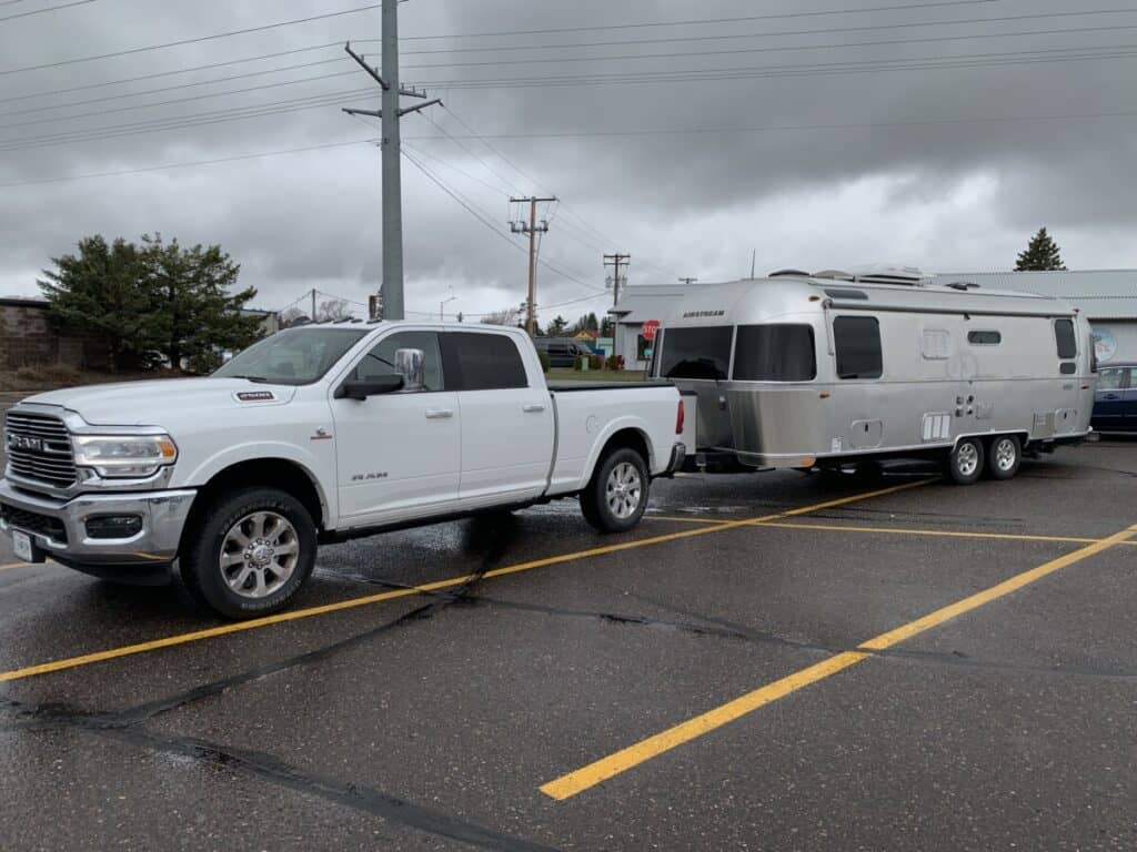
We bought our first RV and could hardly stand the wait for our first shakedown trip. The trip had to be a short one, no more than a couple of hours away from home, so we could get back relatively quickly if we discovered that we forgot something or found that something in our used RV didn’t work as expected.
That first trip took us from Kansas City (KCMO) to Arrow Rock State Historic Site, about an hour and half east. By planning that short trip, we began to familiarize ourselves with all the logistical questions that had to be answered for a trip of any distance.
How do we decide where to go and once that is done, what route do we take? What sites and activities should we consider after arrival? How do weather patterns and forecasts impact where we are going to stay or our route of travel?
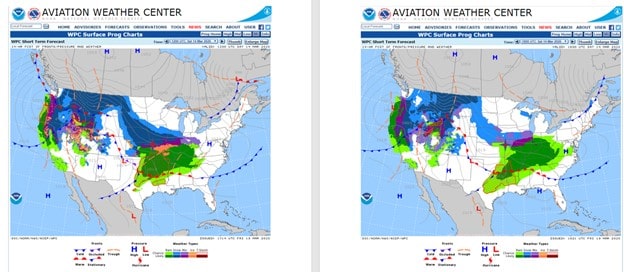
I found a few websites and applications that answered my questions, then found similar resources with one or two extra features that I thought would be useful. It did not take long for me to have a large pool of resources that was too big and difficult to use effectively.
It was hard to keep track of which website or app had the specific feature I wanted to use and until I became more familiar with them, I tried to use them all for every trip. That made planning more complicated and un-fun than necessary. Then I started to organize my toolbox and simplified my planning process.
After gaining some experience and getting more familiar with website and application capabilities, I settled on a slightly different approach to their use. I’ll get to that in a couple of minutes, but for now, I would like to share the 16 best RV planning apps that we have in our toolbox.
What applications are best for RV travel planning?
The best websites and applications for RV travel planning provide valuable information in four categories: Weather, Destination Planning, Navigation, and After Arrival. RVers need at least one website or application from each category to manage an RV trip effectively.

I start looking at weather along our route and at our destination days, sometimes weeks in advance. The weather outlooks informed our destination and route choices as described in an article I wrote about our trip planning process. You can read that article here.
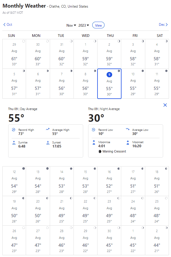
Weather.com is my primary source for forecasts and current weather conditions because I can find nearly everything I want in one place. The monthly forecast is one of this site’s most useful products because I can plan for the average temperatures, precipitation, and even moon phases. That’s handy when looking specifically for a dark-sky park.

Drive Weather uses the National Weather Service’s forecast to illustrate weather along a driver’s route. It includes wind speeds, temperature, and radar.
This app is good for a quick, basic view because it includes icons showing sky cover and precipitation along the route.

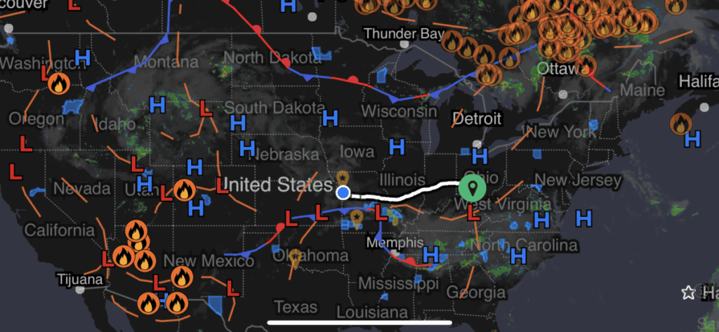
MyRadar is an easy way to look at severe weather. It centers the view on the user’s location but allows users to zoom in and out to get a better perspective. A play button turns a static display into a dynamic one showing a storm’s progression across the region.
Like most weather apps, this one includes severe weather alerts but one of my favorite features are the hyperlocal warning alerts for weather and lightning and predictive warnings before precipitation starts. For example, alerts delivered to my watch will read, “ Moderate rain starting in x minutes, possibly stopping within….” The app displays watches and warnings, but users can also add overlays to the map for things such as lightning, wind speed animations, wildfires, earthquakes, hurricanes, driving routes, and more.
I use Campendium (a Roadpass application )for a quick, initial search. The search tool filters to current location, City or State, National Parks, National Forests, State Parks, or Campground Name. The search can also be initiated through menu links at the top of the page that include the filters listed above, but also includes a Free Camping filter.
The reviews are very accurate and include pictures of the campground and/or the specific sites mentioned in the contributors’ reviews. The review template shows cell service strength by provider as well, so we have a good glimpse into the cell provider and signal strength available at the site.
You can see the reviews I wrote for the website here

Antennas on cell towers provide a wedge of coverage. Cellmapper is a crowd sourced map of cell towers that allow users to see the wedges of coverage for specific areas. By using this app, we can see if a cell signal covers our site so we can connect to the internet using one of our cellular-embedded routers.
Internet connectivity is the “fourth necessity” for most of us for reasons I wrote about here, so this app or one like it is essential in our initial evaluation of a site.
Experienced travelers refer to a guideline that informs their planning decisions called the 2-2-2 rule or 3-3-3 rule.
The RV travel 2-2-2 rule means traveling 200 miles, arriving by 2:00 pm, and staying for two nights. The 3-3-3 rule is a tweak, signifying a 300-mile journey, 3:00 pm arrival, and a 3-night stay. The rule is used to reduce travel fatigue and enhance traveler safety
We plan to avoid long travel days, but every now and then, we need to go a long distance and simply need a place to park overnight.
Harvest Hosts are great for that. We can overnight for no cost at farms, museums, wineries, breweries, and golf courses.
The unwritten rule is that if we stay at a Harvest Host site, we buy something from the host, so our stays are not actually free. But Harvest Hosts are very convenient and one of our default planning resources when long-distance travel is required.
Some of our best destinations have been at Harvest Hosts locations because of the unique experiences and our interaction with the owners/operators of the site.
This is a Referral Member Link and we are compensated when you purchase a membership from Harvest Hosts or sign up as a host on Harvest Hosts.

Recreation.gov opens a huge number of resources to us in terms of recreation and education. It is used by fourteen partner organizations to bring details and descriptions of sites and activities for lands, monuments, and buildings within their jurisdiction. This includes the National Park Service, Bureau of Land Management, US Forest Service, Smithsonian Institution, and more.

We use this site to reserve campsites, make timed entry reservations, and purchase tickets for tours such as the River Styx Tour at Mammoth Cave.
State Park campgrounds are often designed with more separation between pads, so they do not feel as crowded as some of the commercial parks we have visited. In our experience, most sites offer electric service only with water and dump stations located elsewhere in the park. The parks we stay in are less expensive than commercial providers.
They are sometimes found near obscure, but historically significant locations and sometimes, those locations are in sparsely populated areas. Arrow Rock State Historic Park in Missouri is an example. I wrote an article about it that you can read here. State parks are one of our favorite campground types and each state offers online selection and reservation websites.

Roadtrippers, a Roadpass application… is a route planning application that includes a fun feature – it will show local attractions along a corridor of your route allowing you to make little side-stops at some interesting and sometimes quirky attractions. The application also allows the user to set RV dimensions and produces RV safe GPS navigation.
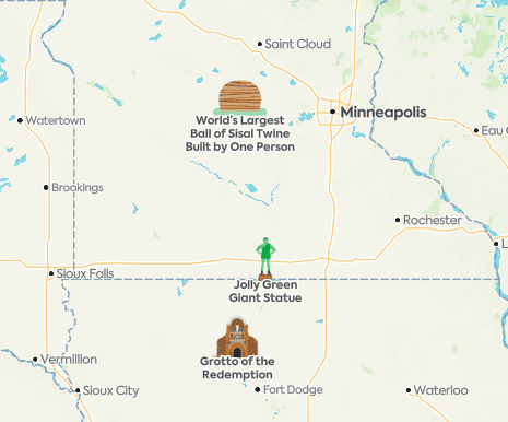
I usually enter a route into RoadTrippers to see if there are any interesting diversions along the way. Once I decide on a route, I will open Trip Wizard and add the route to the master driving plan we maintain there.

RV Trip Wizard is one of our go-to route management applications for a few reasons as shown below. First, one of the application settings allows us to set distance rings by miles or hours driven. In the example below, I set the distance rings to 300, 400, and 500 miles. Also notice the fuel warning which Trip Wizard calculates based on the vehicle settings in our profile.
The application has a weather overlay to show precipitation along the route and a wind overlay that can be displayed as well.
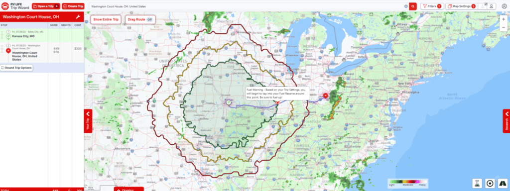
RV Trip Wizard is one of my favorites, primarily because I can click at any stop on my planned route and see distance rings that illustrate our travel thresholds from that location. We may stop at a couple dozen sites in a trip that takes an entire calendar year and I build the master driving plan here.


Waze is a real-time, crowd sourced navigation application. Users report vehicles on the side of the road, police, fog, objects in the road, heavy traffic, and more. We avoided potential damage several times because someone ahead of us reported an object in the road and we had time to look for it and avoid it.
I use Waze for every trip because of the driving conditions reported by drivers ahead of me. I also like being a part of the traveling community and reporting real-time hazards and conditions myself.
Waze has a couple of habits, however, that keep me on my toes.
First, it will often take me off main thoroughfares and direct me through multiple left and right-handed turns through neighborhoods just to avoid a single turn at a major intersection and to shave a few seconds off the trip.
Second, Waze is a crowd-sourced application so drivers can push updates for construction or closed roads in real time. On rare occasions, updates are not reversed. The picture below is an example of an update that should have been made but wasn’t. Waze showed a closed intersection where we needed to turn for the last mile to our campground and were routed around the closure. We learned later that the intersection was not closed at all.
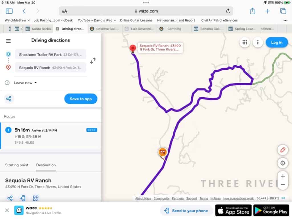
After making the left turn off the highway, the road narrowed to barely one lane and wound through steep hills in the neighborhood. On one of the curves, the road was supported by a bank eroding from a flooded river on one side and a rockslide blocked a portion of the lane on the other. The bumper on our airstream was scuffed up and we lost a snap-pad on a dip in the road just before a very small bridge with no guard rails.
Never again. We had to find a better way to navigate. We learned to open an RV Safe GPS to cross check Waze.
During the route planning exercise prior to all of our trips since then, I plug our route into the RV safe GPS and transcribe the route in my reporter’s notebook.
As we travel down the road, we default to Waze, but continually monitor our progress on a second device running an RV safe GPS and compare the routes in real time. We also double check road closures marked on the map to ensure that we do not make the same mistake as before. By using two navigation apps, referring to my notebook, and visually verifying road closures that result in detours, we avoid the complexity that Waze sometimes builds into the navigation.

When we travel on the interstate, I like to know what is ahead of us so we can plan our stops appropriately. This application uses my device’s location to show milage to the upcoming exits in real time. It also shows the services at exits.
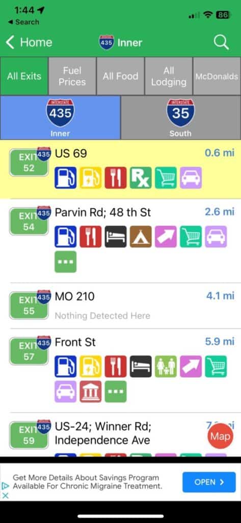
Tap on the exit, and the services are categorized with specific gas station, restaurant, hotel names etc. along with the direction to turn and distance. We can search for specific services such as food at McDonalds and we will get a list of locations with mileage.
Rest stops are clearly marked in the app as well and it makes pulling off for a quick bio break very easy.
TSD Open Roads is an RV diesel discount program that has saved us hundreds of dollars in fuel costs. We fuel in truck lanes at truck stops because it is easier to get in and out with our Airstream. If we stop at one of the partner locations shown in this application and fuel in the truck lanes, we will receive a fleet discount for the purchase.
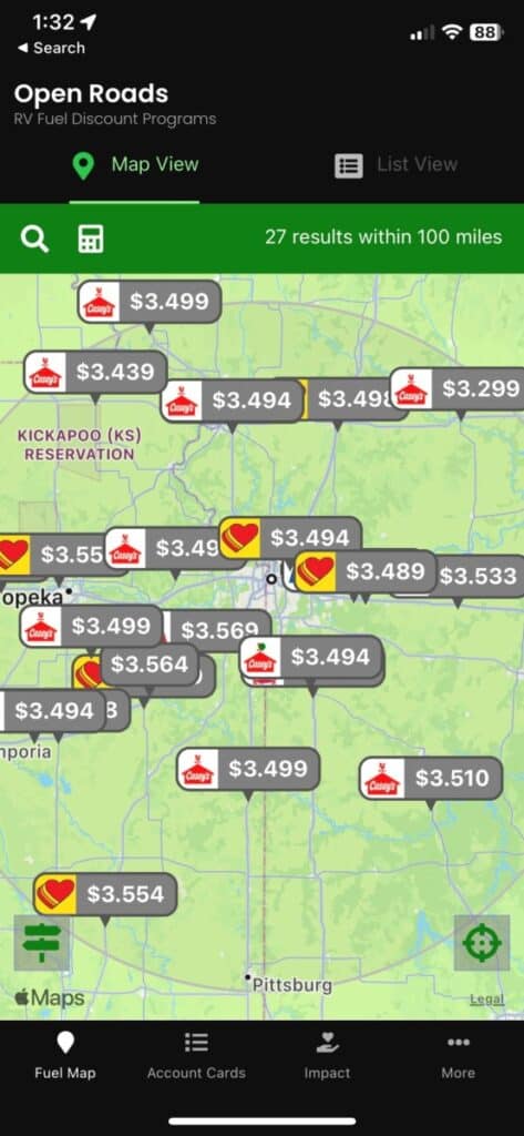
Sometimes, discount amounts per gallon are measured in dimes and nickels, but that adds up. We occasionally find partner locations offering as much as a dollar off per gallon and because I have a large fuel tank (52 gallons), we have seen discounts of $40 dollars or more.
Having the range to find those partner locations is one of the reasons I upgraded from a 31 gallon to an aftermarket 52-gallon tank. You can read about the upgrade and its benefits here.

The National Park Service website and app allows users to search for parks by name, state, activity, topic, type, or by the user’s current location. The app describes the park and includes links for visitor centers, passport location, things to do, and park news. All the information can be downloaded so users do not have to rely on an internet connection for information once inside the park.
Information related to timed entry and tour tickets can be found here, but purchasing those items is done through Recreation.gov.

Parkwolf is a National Park app that displays current location and direction, and guides users through the park with real time information on landmarks, pull outs, trailheads, and amenities. It also shows wildlife hotspots and sightings. The app includes alerts, news, other park maps, and works without Internet and cell connections.

Trip Advisor is a website that reviews businesses and activities by location. The data is sourced from users who report their experiences, so the risk of having a biased report from the business itself is limited.
We often stay in a location for one to two weeks and we use Trip Advisor when we are looking for something local, something outside of the national or state park system.
Earlier in this article, I mentioned that I would tell you how we changed our approach to using apps. Plans inevitably change so the time spent building a complete plan is wasted effort. Instead of trying to use multiple websites and apps to harvest every bit of information all at once, we focus now on one within each category. Sometimes two.
We always began our planning process early, but today, we consume a little data from one app from each of the categories instead of trying to compare all data points from each app at the same time.
Over time and over thousands of miles traveled, we learned to avoid complexity in planning as much as we can. We learned that one application is not effective in all situations, so we choose from a toolbox and use just a couple of websites and apps only when needed. We take our time with the planning process and we keep it simple enough, but not too simple. We make the planning only as complex as needed, and no more. That helps keep this lifestyle fun.
Hope this article helps you plan, navigate, and thrive during your travels. See you down the road.
NomadicNeighborhood is a participant in the Amazon Services LLC Associates Program, an affiliate advertising program designed to provide a means for sites to earn advertising fees by advertising and linking to Amazon.com. We also participate in other affiliate programs which compensate us for referring traffic.
How to Empty a Composting Toilet: Legal considerations and more
Composting toilets divert liquid and solid waste into separate tanks, and each must be emptied independently. Liquid waste is dumped into dump stations, vault toilets, or flush toilets. Solid...
Empty a Black Tank: 16 Steps That Include a Test and Preconditioning
[wpcode id="2133"] When I first started RVing, it took me close to an hour to empty the black and gray tank. I was learning and didn’t want to make a mess, so I took my time. As I gained more...